FLOOD RISK ANALYSISSpatial Analysis of Compounding Risks: Floods, Hazardous Waste, and Inequities
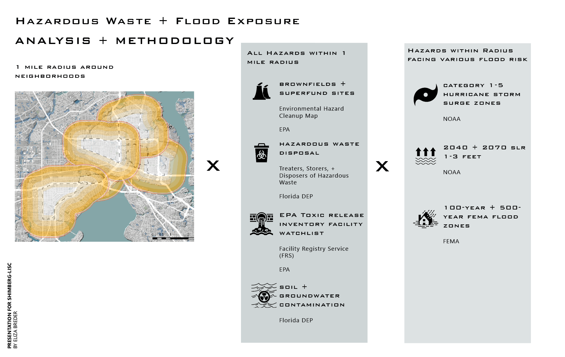
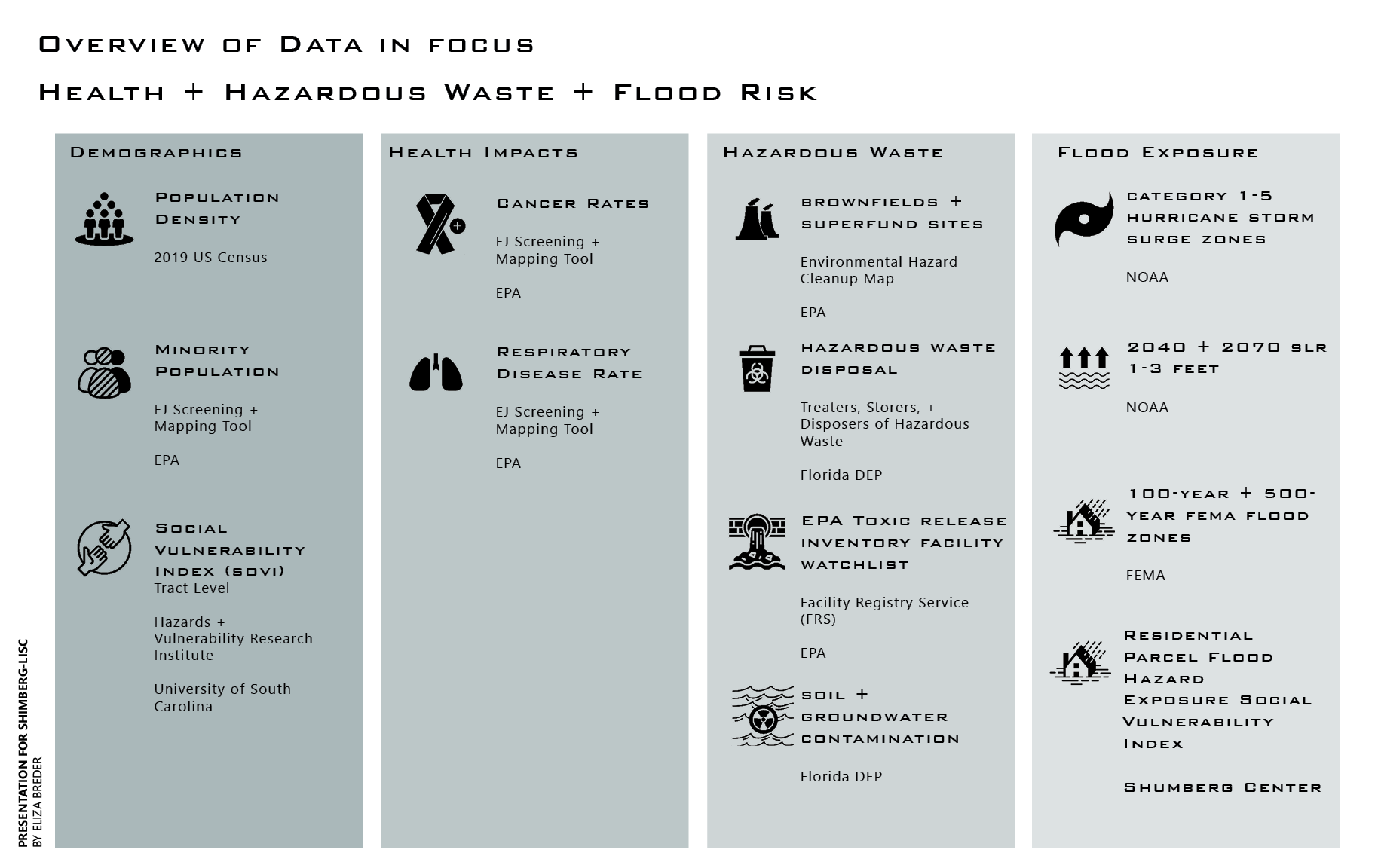
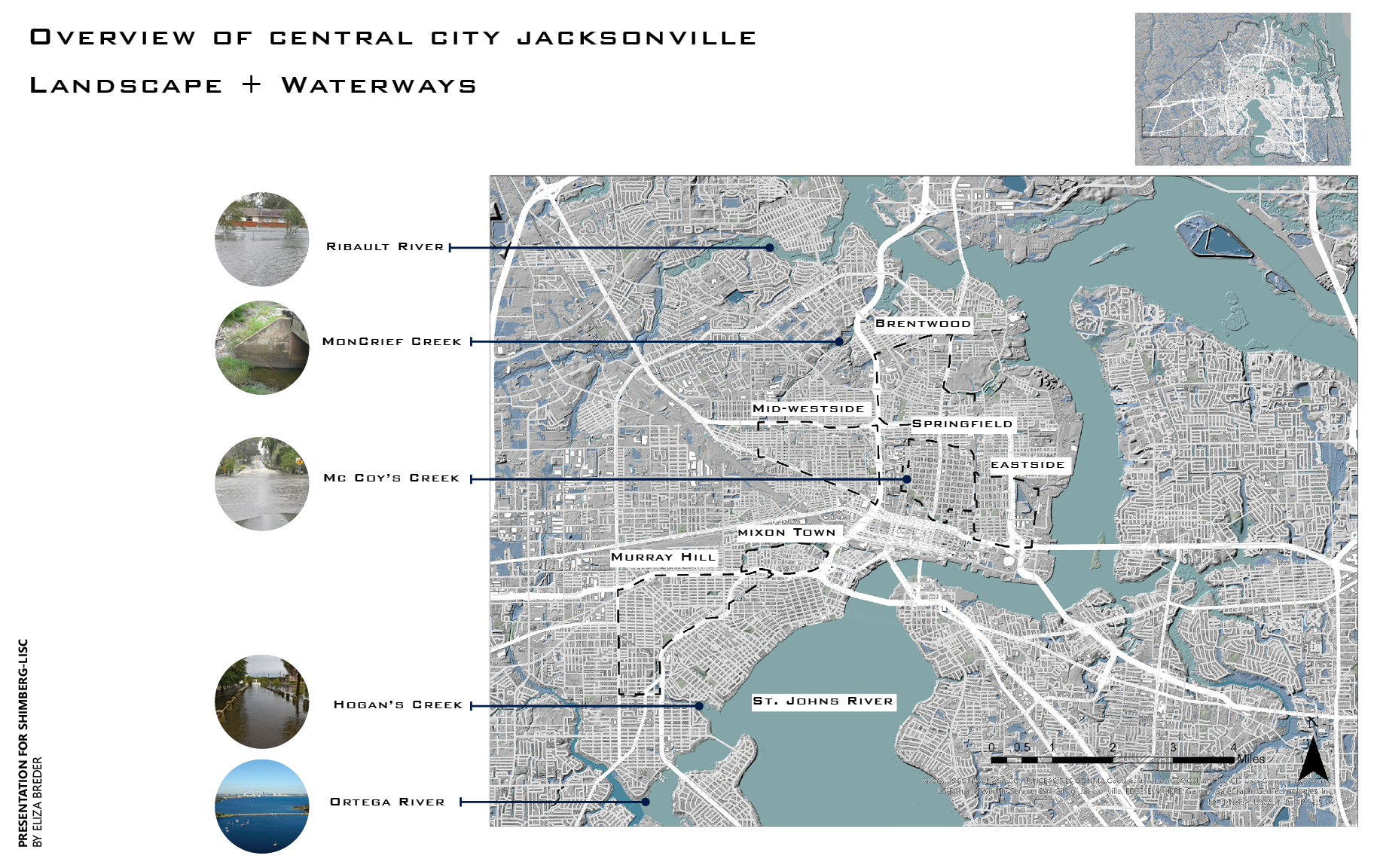
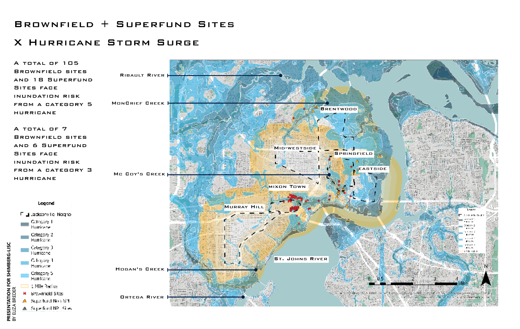
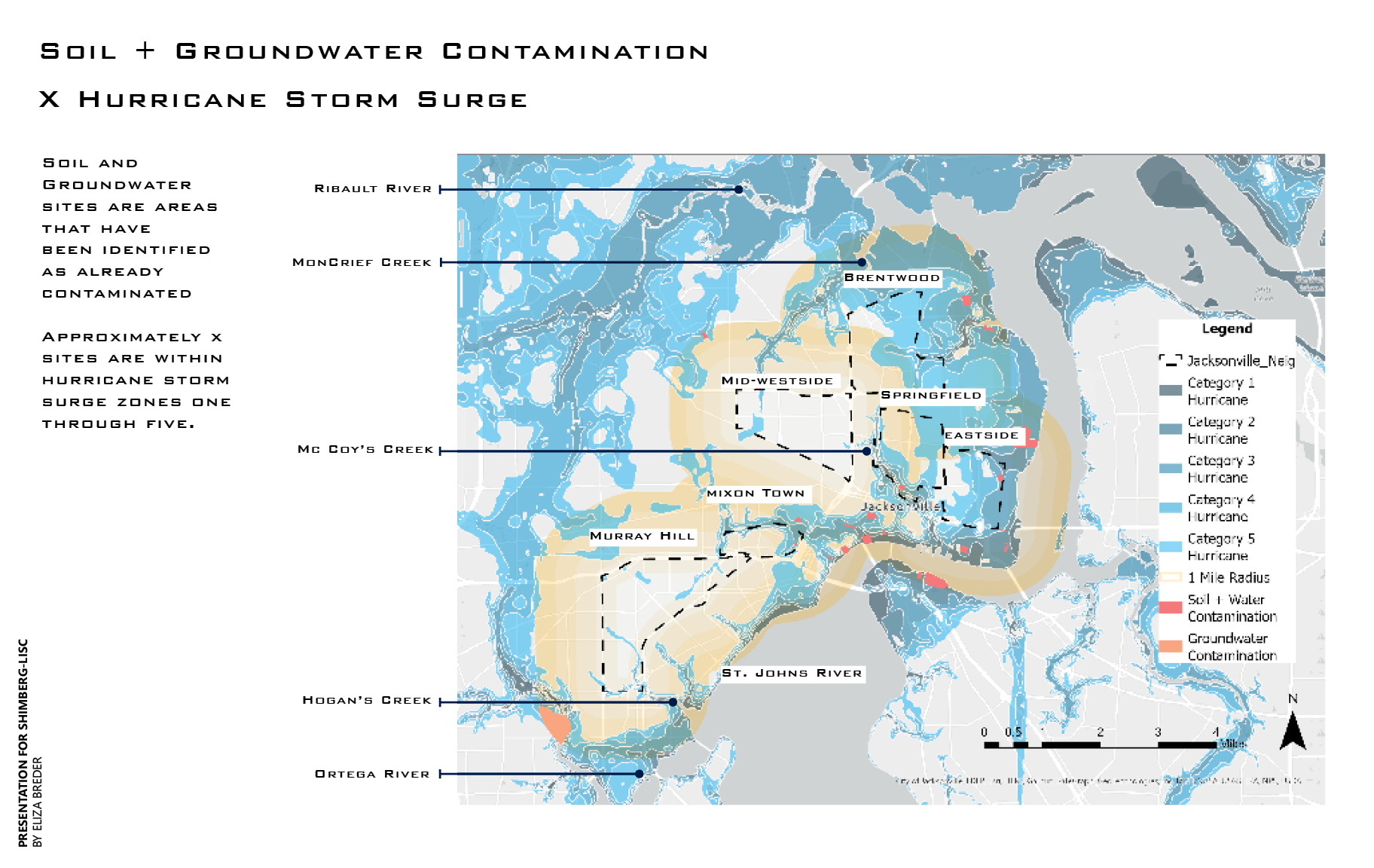
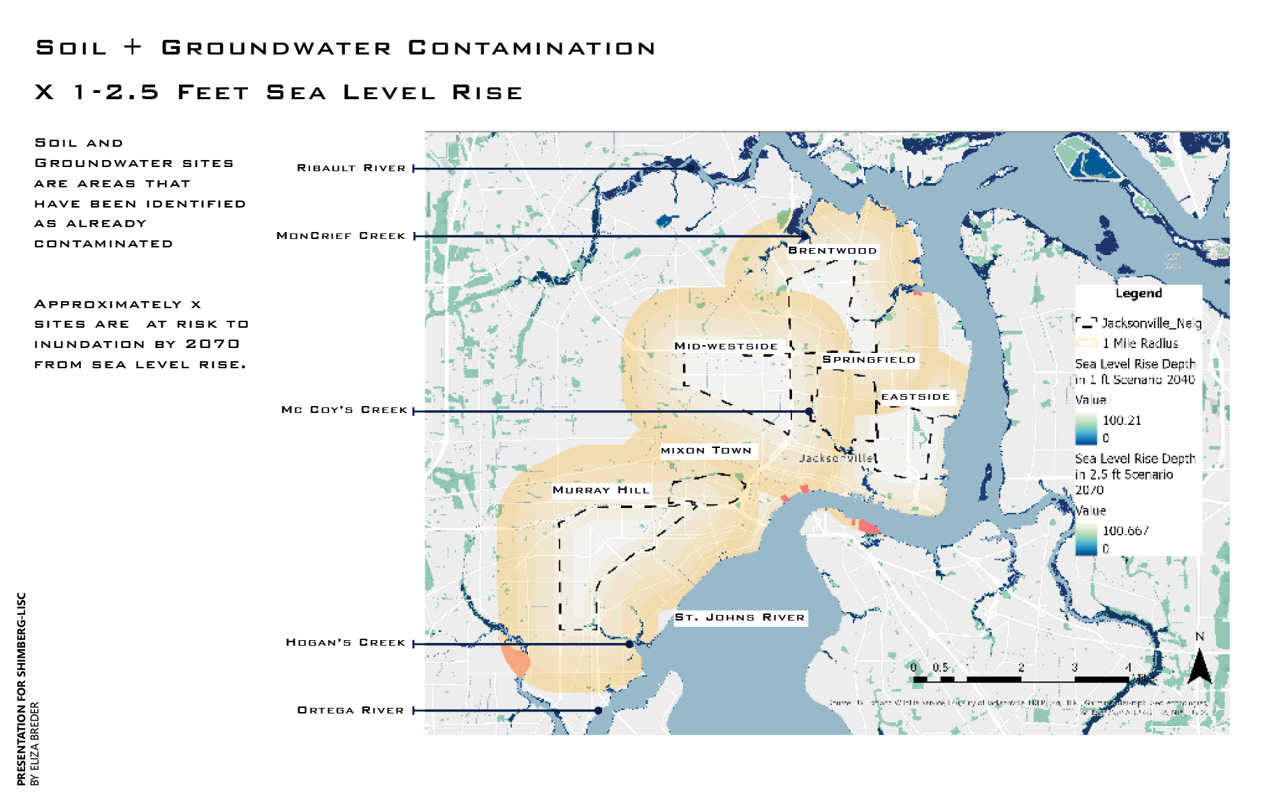
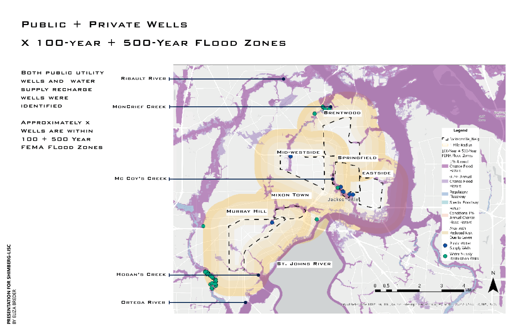
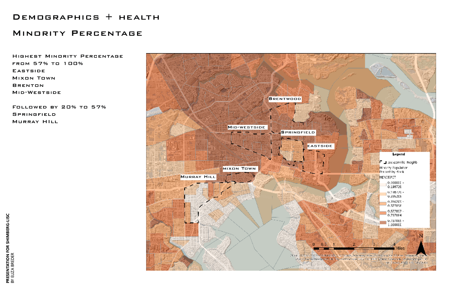
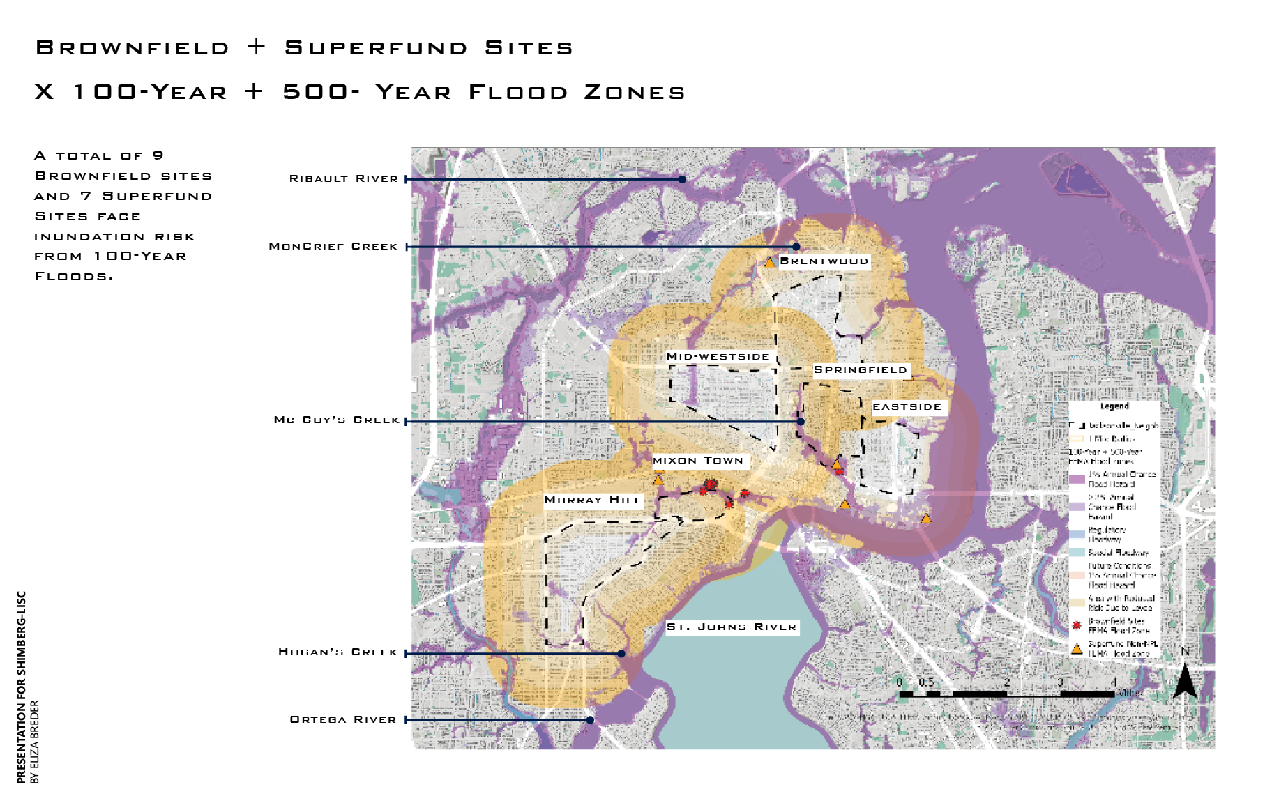
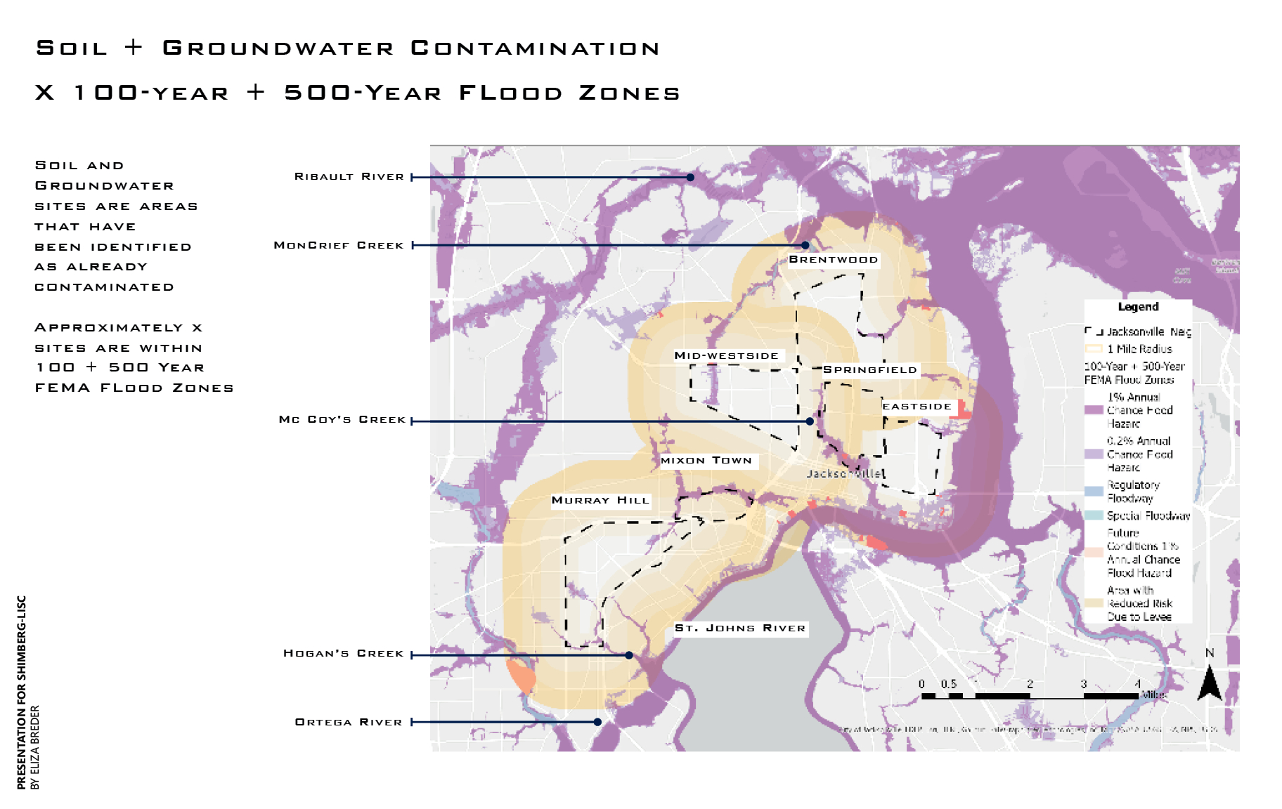
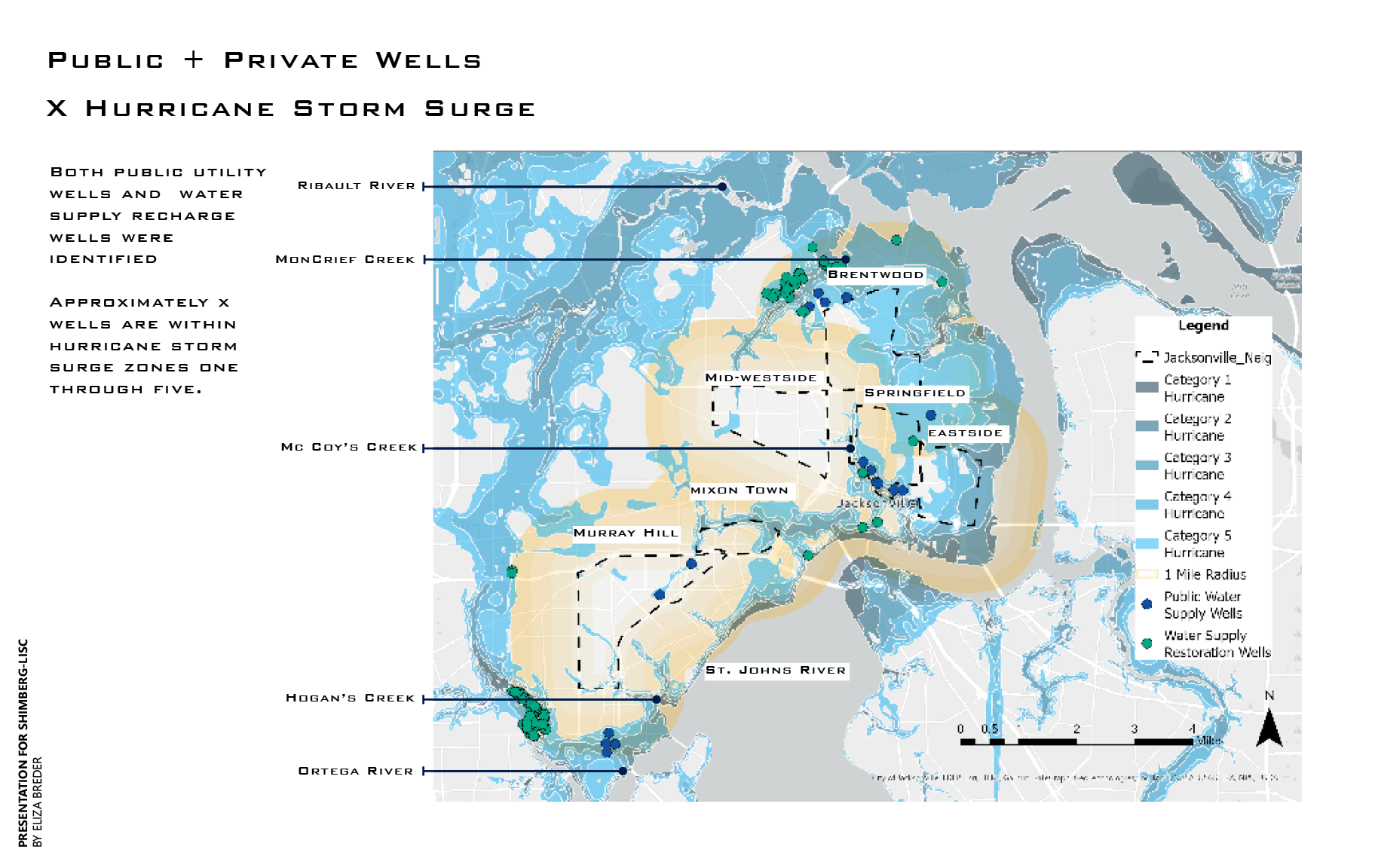
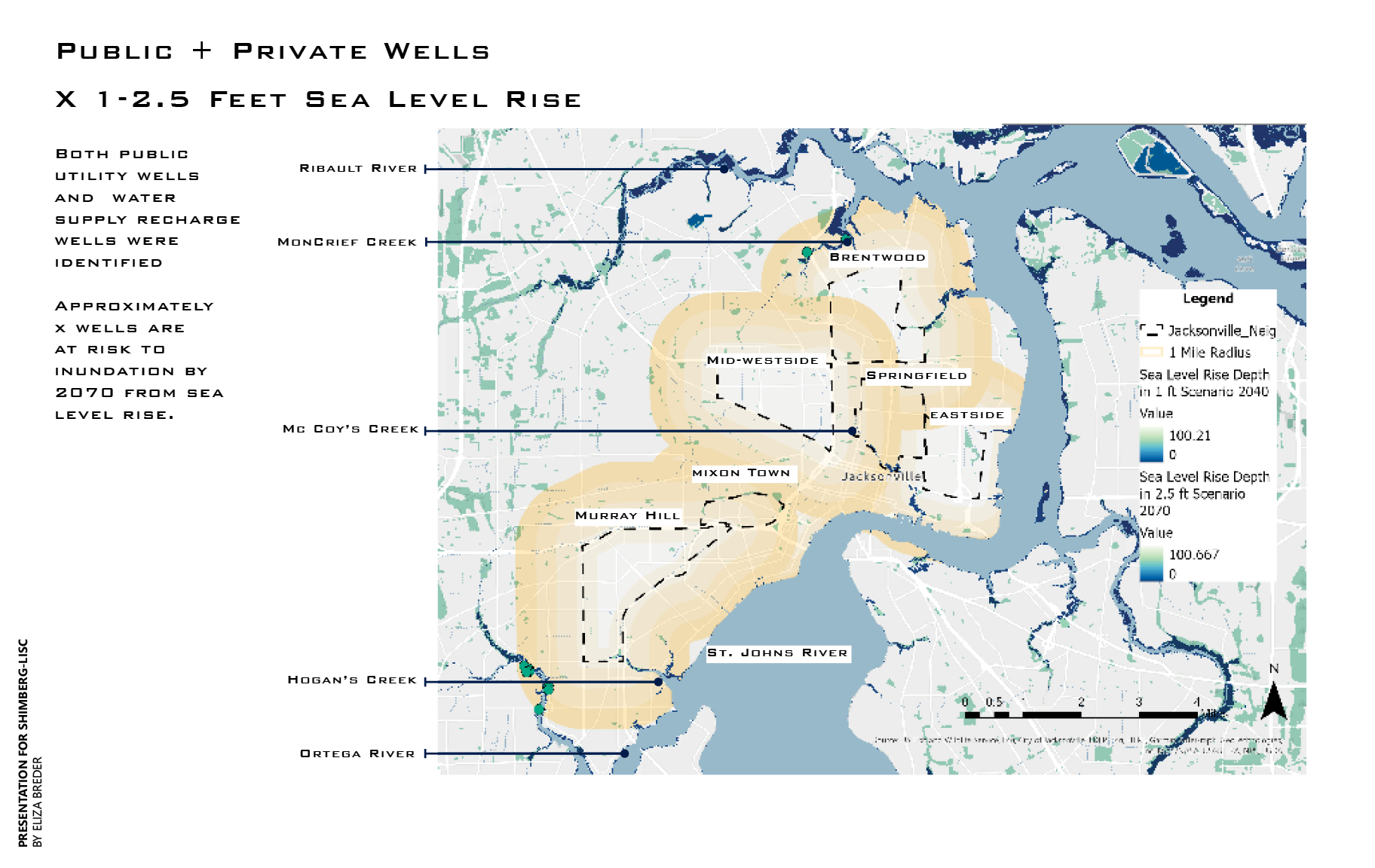
Jacksonville’s historic port and industrial areas were disproportionately located near Historically and predominately Black communities. This historic port was once low-lying marshland and was infilled by industries in the early 1900s. These areas have existing brownfield sites that are continuously flooded by rising sea levels, hurricanes, and all exacerbated by rising water tables from sea level rise. Demographics of the region, social vulnerability, various flood risks, and various environmental hazards are mapped and an analysis was completed that shows compounding impacts.
SITE: Jacksonville, Florida
TYPE: Cartography + Geo-Spatial Analysis
DATE: 08/2023
TEAM: Eliza Breder
Analysis was done in ArcGIS Pro and includes demographics, hot spot analysis, and Euclidean distance.
Consulting for SHIMBERG Center for Housing Studies
